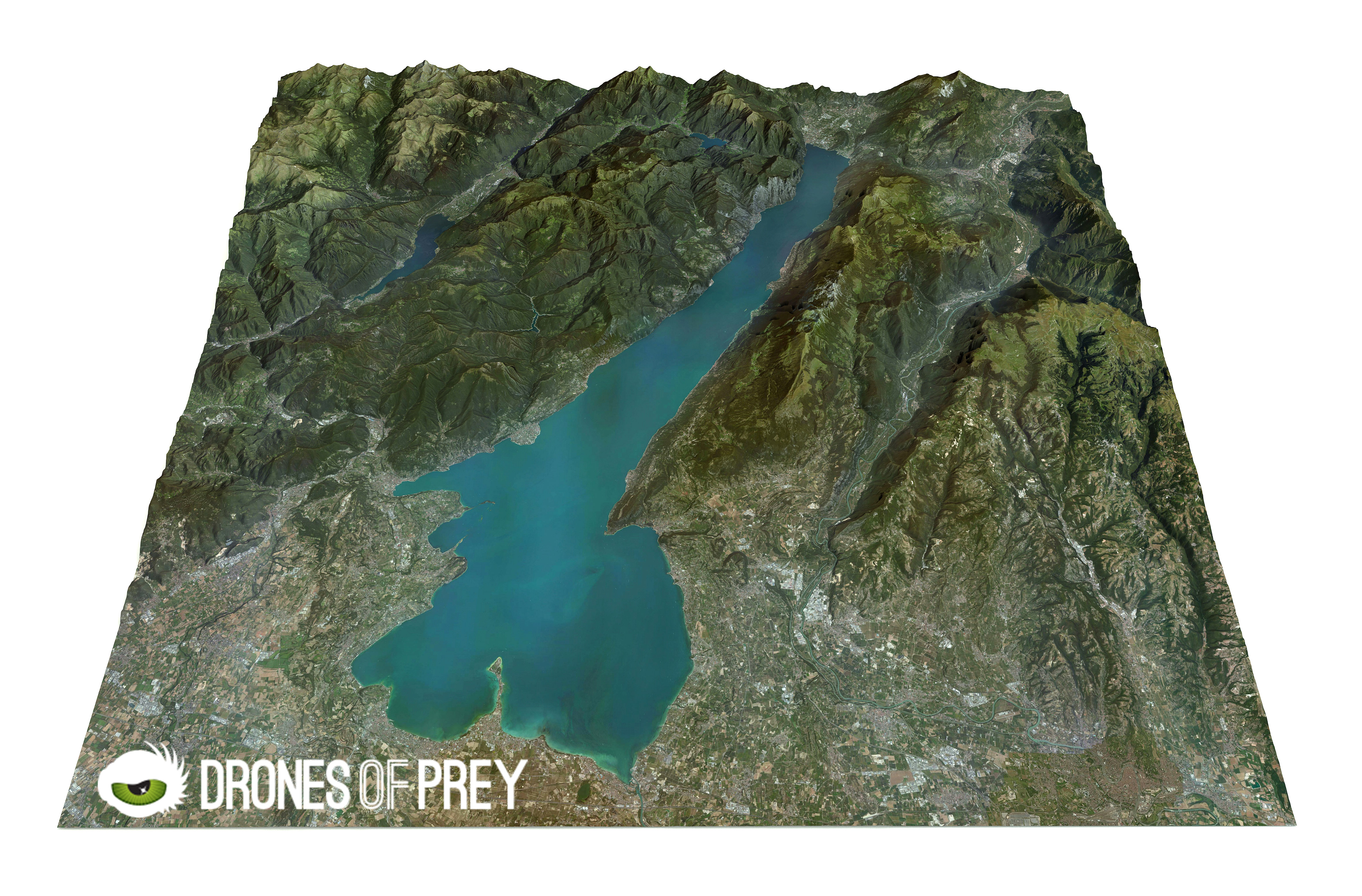
2D or 3D mapping creates a precise map from aerial images and it gives a result that does not look like the type of map you buy at a gas station. But it is an accurate picture of terrain – which includes all buildings and all the natural components of the terrain. This mapping gives a sense of size and depth. It is often combined with other information, like the thermo graphic data or the industry-specific data to make the map a useful tool.
When you are creating a 2D or 3D map using drone aerial technology, the focus basically is always where the drone camera is pointing so whether you are in need of a map or modeling of statues and the like. This type of process requires that many photos be taken by the drone from a specific flight path, or waypoint, which is essentially superimposed to create the necessary end result.
The benefits of photogrammetry
Photogrammetry, is beneficial to so many industries like the mines, rock quarries, engineering companies, forest management, pollution modeling, archaeology, cellular network planning, urban planning, forestry management, oil and gas exploration, transportation planning, and so many others.
They have been known to their lower cost and also the ability to take close aerial photographs on sets, for real estate information, agriculture, urban planning, forestry management, oil and gas exploration, cellular networking planning, transportation planning, and more. This technology is always expanding. 2D and 3D mapping services are finding their way in a wide variety of applications, from construction to pre-site planning and many others.
Using 2D or 3D information creates a realistic view of a particular region, the views they create are always numerous and also goes beyond the simple notion of cost effectiveness. Together with the experience of realistic 2D or 3D mapping in visualizations, it uses algorithms such as signal propagation algorithms, and this creates a great advantage for local authorities, telecommunications, and consulting firms.
Photogrammetry and 2D or 3D mapping produces faster results & cuts the field time
In the past, this could take days or even weeks to complete. Using photogrammetry or multi-dimensional mapping, we may complete the same task in a single day. This service also allows us to complete fly-through, detailed animations and maintenance materials in less time than ever before. Photogrammetry and dimensional mapping is very accurate in aerial drone service and produces the most accurate data available. This solid knowledge base helps us plan better projects for our clients.
Photogrammetry and 2D or 3D mapping is a versatile tool for aerial drone services, budget, and chronological preparation, implementation of applications, historical preservation, the scope of once-impossible areas, and detection of changes, risk-taking and reconstruction of accidents. It is also useful when producing detailed topological maps, volumetric calculations, 2D drawings, 3D models and more.
In general, photogrammetry and 2D or 3D helps us better understand the construction conditions, and this allows us to make better decisions regarding our projects. For more information on Drones of Prey’s aerial drone services, contact our team today.
Thank you for explaining why drones can be good for 2D & 3D mapping. It’s kind to know that photogrammetry is actually very accurate. Perhaps it could be good to learn if the drones are consistently accurate or even more accurate if they are surveying a smaller portion of land.
Happy to help and yes, they would be consistently accurate and able to survey smaller parts of land. Thank you for stopping by